The Westfjords

The Westfjords of Iceland are a remote and stunningly beautiful region, known for their dramatic landscapes, deep fjords, and rich wildlife.
Home » Destinations » Europe » Iceland » Westfjords

Explore The Westfjords

The Westfjords are located in the northwest of Iceland, forming a large peninsula connected to the mainland by a narrow isthmus. It is one of Iceland’s oldest regions, with landscapes shaped by millions of years of volcanic activity, glaciers, and the sea.
The Westfjords are less visited than other parts of Iceland, offering an off-the-beaten-path experience with fewer crowds offering a sense of stepping back into a more serene, wild Iceland. Many roads are unpaved, winding, and can be affected by weather, especially snow in winter. A 4WD vehicle is highly recommended.
Be prepared for variable weather with rain, wind and snow; layers, waterproof clothing, and sturdy shoes are essential.


The Westfjords

Budardalur is a small village located in the Dalabyggð municipality in West Iceland, at the entrance to the Westfjords. Good spot to get lunch, gas, groceries and coffee.

Langárfoss is a lesser-known waterfall located in the Westfjords region of Iceland, near the village of Ísafjörður. It falls about 100 meters (328 feet), making it one of the higher waterfalls in the region. It tumbles down a steep, rocky cliffside into a narrow valley.

Route 60, also known as Vestfjarðavegur or Vestfirðir Road, is a vital artery in the Westfjords region of Iceland. It stretches through some of the most scenic and remote landscapes of the country, connecting the southern parts of the Westfjords back to the Ring Road (Route 1).

Hellulaug Hot Springs is nestled near Vatnsfjörður on the southern coast of the region. It is a small, natural geothermal pool with a diameter of about 3 to 4 meters and a depth of around 60 cm. The water maintains a consistent temperature of approximately 38°C (100°F), making it ideal for bathing year-round.

Brjánslækur is a small village situated on the southern coast of the Westfjords, at the mouth of Vatnsfjörður. Brjánslækur is the departure point for the ferry Baldur, which sails across Breiðafjörður to Stykkishólmur on the Snæfellsnes Peninsula. This service is vital for connecting the Westfjords to other parts of Iceland, especially during summer months.

The westernmost point of Europe and home to one of the largest bird cliffs in the world, where you can see puffins, razorbills, and other seabirds up close.

A unique beach with red, pink, and golden sands, offering a striking contrast to the typical black beaches of Iceland.

The Dynjandisheiði mountain pass connects Arnarfjörður in the north with Barðaströnd in the south. It up to 500 meters (1,640 feet) at its highest point, offering panoramic views of the surrounding fjords and landscapes. The road over the pass was constructed in 1959, marking the first car-accessible route to Ísafjörður from the south, significantly improving connectivity in this rugged region. The road is primarily gravel, which can make it challenging during winter and after heavy rain or snow.

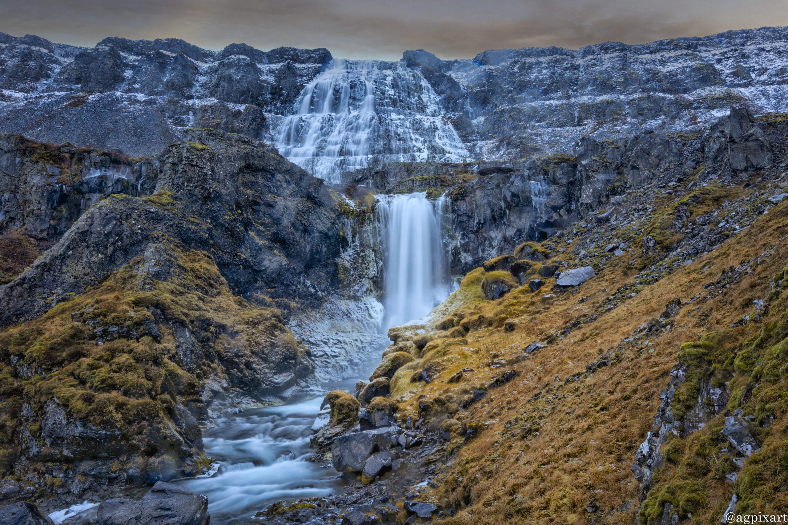
Dynjandi, also known as Fjallfoss, is a waterfall located at the end of Arnarfjörður fjord. It is the largest waterfall in the Westfjords, with a total height of about 100 meters (328 feet). It’s unique for its shape, being 30 meters (98 feet) wide at the top and widening to 60 meters (196 feet) at the base, giving it the appearance of a bridal veil. Below it are five other waterfalls: Háifoss, Úðafoss, Göngufoss, Hundafoss and Bæjarfoss.

The oldest part of Ísafjörður with the town centre is located on a spit of sand, or eyri, in Skutulsfjörður, a fjord which meets the waters of the larger fjord Ísafjarðardjúp. With a population of about 2,600, Ísafjörður is the largest settlement in the peninsula of Vestfirðir and the administration centre of the Ísafjarðarbær municipality, which includes—besides Ísafjörður—the nearby villages of Hnífsdalur, Flateyri, Suðureyri, and Þingeyri.

The site of Iceland’s oldest manmade tunnel in Iceland, completed in December 1948. It is located in the Westfjords between Ísafjörður and Súðavík, along Route 61.

Súðavíkurkirkja is located in the village of Súðavík, which lies on the western coast of Álftafjörður in the Westfjords region of Iceland. Originally, this church was built in 1899 in Hesteyri, another village in the Westfjords, by Norwegians for the workers of a whaling station. When Hesteyri was abandoned, the church was dismantled and then rebuilt in Súðavík in 1960, where it was consecrated in 1963.

Route 61, known locally as Djúpvegur, is a road in the Westfjords region of Iceland, connecting the coastal town of Bolungarvík to the larger road network via Route 60. It begins at Króksfjarðarnes on Route 60, travels through Hólmavík, and extends to Ísafjörður, where it meets Route 60 again. Length – 266 km.


Instructions for photo proofing and comments:

Left-click on the photo to access options for title information (i), leave comment, or mark the photo(s) as the favorite. The option to submit the selected as favorite photos is under “Submit proofs” button under photo gallery.


The Westfjords Photos
(Click on Photo for More Info)

Other Regions of Iceland
NorthWest
Coming Soon…
North
Coming Soon…
East
Coming Soon…
South
Coming Soon…
Other Regions of Iceland
NorthWest
Coming Soon…
North
Coming Soon…
East
Coming Soon…
South
Coming Soon…

Home » Destinations » Europe » Iceland » Westfjords