
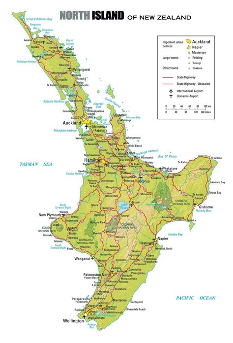
The North Island, New Zealand
The North Island is New Zealand’s warmer, more populated half. It offers a diverse mix of vibrant cities, dramatic volcanic landscapes, lush rainforests, and beautiful beaches.
Explore The North Island, NZ
Te Ika-a-Māui, The Fish of Māui
The North Island of New Zealand offers a perfect mix of vibrant cities, dramatic geothermal landscapes, stunning beaches, rich Māori culture, and world-famous film locations. More populated and milder than the South Island, it features excellent roads that make scenic driving a pleasure.
Volcanic and geothermal activity define much of the island, from active volcanoes like Mount Ruapehu to the vast Lake Taupō — formed by one of the largest eruptions in human history. You’ll also find rolling farmland, lush native forests, and subtropical beaches in the far north (Northland).
Covering 113,729 km², roughly the size of England or the US state of Virginia, the North Island is home to about 3.8 million people — approximately two-thirds of New Zealand’s total population. Auckland alone is home to around 1.4 million residents. Overall, the climate is noticeably milder and warmer than the South Island.
The main hubs — Auckland, Wellington, Napier, Rotorua, and New Plymouth — serve as excellent gateways to world-class experiences. Wellington, the nation’s capital, sits at the southern tip of the island.
Good To Know…
International Airports on the North Island, NZ
Auckland Airport (AKL) – NZ’s Main International Hub — Handles the majority of long-haul international flights (from Europe, North America, Asia, and the Pacific).
Wellington Airport (WLG): Offers direct international flights mainly to Australia (Sydney, Melbourne, Brisbane, Gold Coast) and Fiji (Nadi).
Biosecurity & Customs: NZ has very strict biosecurity rules. Declare all food, wooden/plant items, outdoor gear, and hiking equipment. No fresh fruit, meat, dairy, or honey allowed. Sniffer dogs and checks are common. Fines can be heavy if you forget to declare something. No THC/CBD products allowed.
Baggage Claim: One main terminal — domestic and international arrivals are well signposted.
Car Rental at Auckland (AKL): Most major companies have counters in/near the Transport Hub (International) or ground floor of the multi-level car park (Domestic).
Car Rental at Wellington (WLG): Rental counters are inside the terminal on the Ground Level, near domestic baggage claim — very convenient.
Useful Tips for a Smooth Arrival
Driving & Road Tips
The North Island, NZ – Regions
Wellington & Wairarapa
Wellington, NZ’s capital city known as the Windy City, offers a vibrant café and arts scene, Te Papa museum, and serves as the main ferry gateway to the South Island. Wairarapa, just over the hill from Wellington, is a rural region famous for its rolling green hills, world-class Pinot Noir wineries around Martinborough, and charming small towns.
Manawatu & Hawke’s Bay
Manawatu is a rural heartland region in the lower North Island, centred around Palmerston North. It features rolling farmland, the scenic Manawatu Gorge, and the winding Manawatu River. Hawke’s Bay is one of New Zealand’s sunniest regions, famous for its Art Deco architecture in Napier, world-class wineries, and fertile orchards.
Taranaki & Whanganui
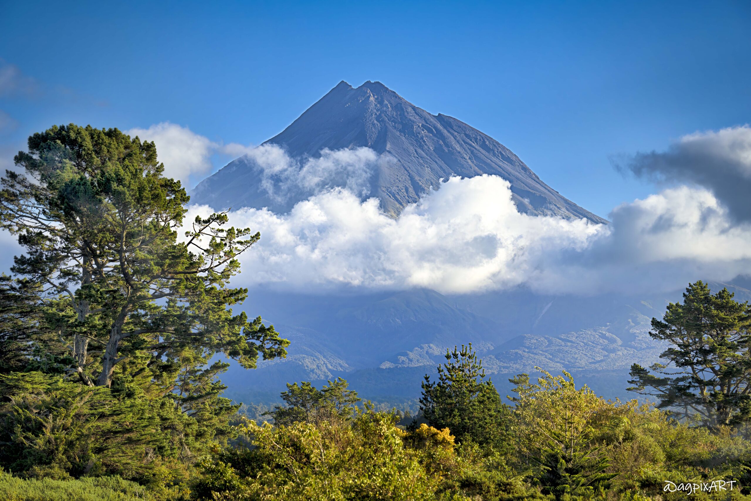
Taranaki is a region on the west coast known for the volcanic cone of Mount Taranaki. It features black-sand beaches, the city of New Plymouth, and excellent gardens and surf spots. Whanganui is home to the mighty Whanganui River, longest navigable river and the heart of Whanganui National Park. It offers a relaxed riverside town and historic heritage.

Ruapehu
Ruapehu is a volcanic region dominated by the active volcano Mount Ruapehu (2,797 m). It includes Tongariro National Park, the ski fields of Whakapapa and Turoa, the towns of Ohakune and National Park Village, and offers world-class hiking, stunning volcanic landscapes, and Lake Taupō views.
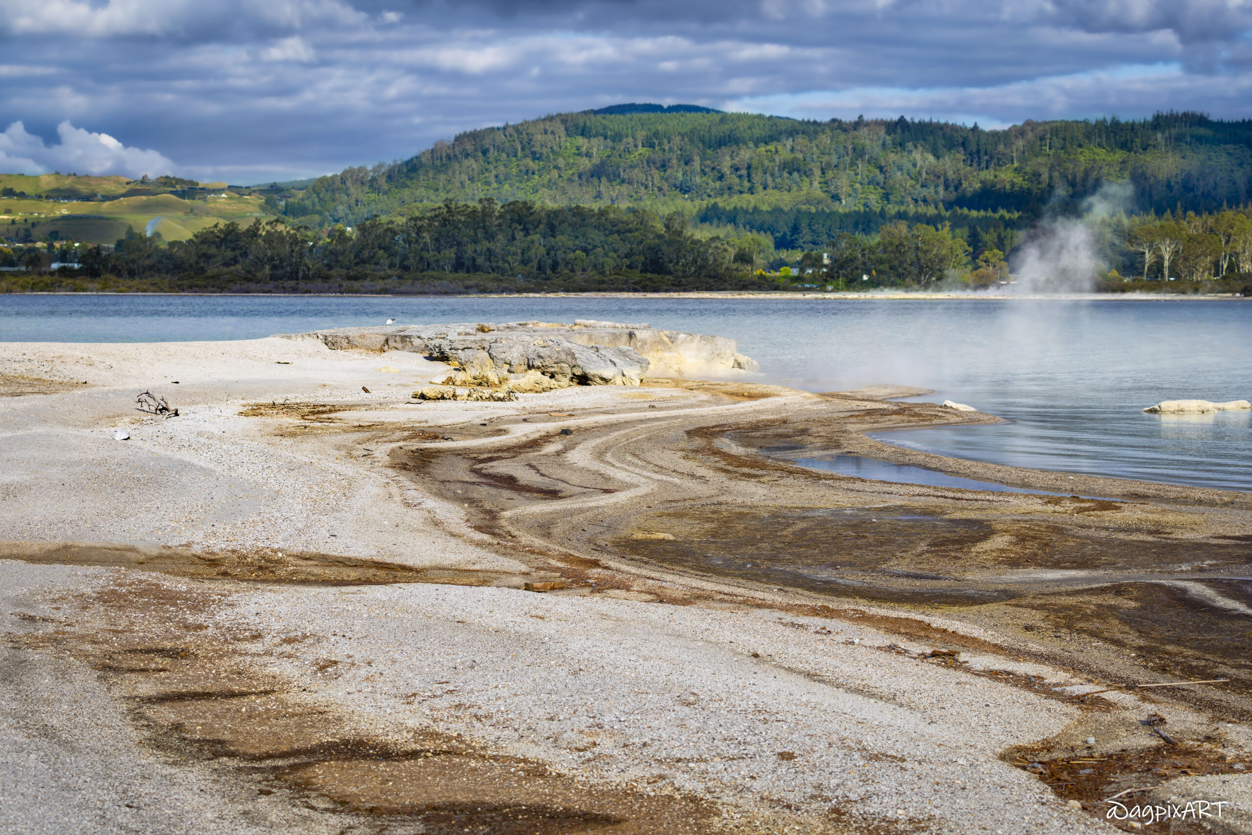
Rotorua & Taupō Volcanic Zone
Rotorua is the geothermal heart of the North Island, famous for its mud pools, geysers, hot springs, and strong Māori culture with traditional hangi feasts and performances. Taupō Volcanic Zone is one of the most active volcanic regions on Earth, centred around massive Lake Taupō.
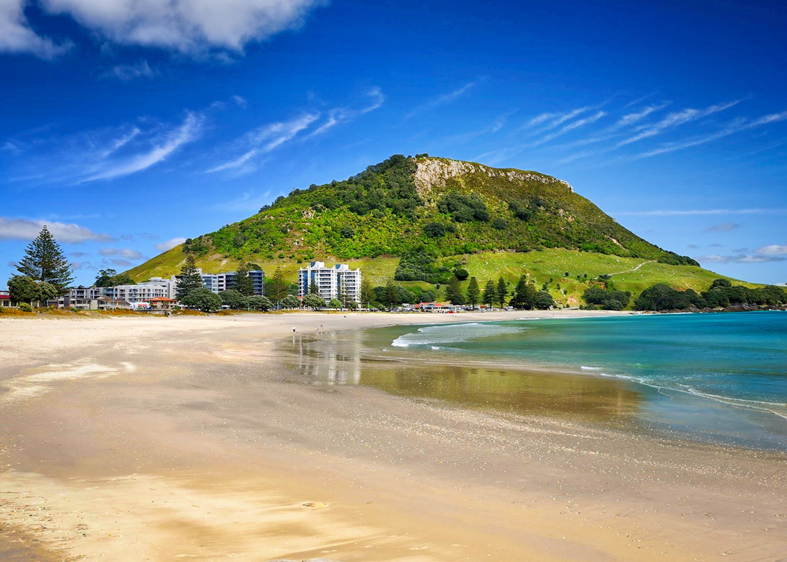
Bay of Plenty
Bay of Plenty is a sunny, coastal region on the east coast known for its golden beaches, relaxed lifestyle, and excellent surf spots. It includes the thriving cities of Tauranga and Mount Maunganui, fertile kiwifruit orchards, and serves as a popular gateway to the geothermal areas of Rotorua.
Gisborne & Eastland
Gisborne is New Zealand’s easternmost city in a laid-back coastal region famous for its beautiful beaches, excellent surf, Chardonnay vineyards, and strong Māori culture. Eastland (the wider East Cape area) is one of the most remote and authentically Māori areas, featuring rugged coastlines, the iconic East Cape Lighthouse, and quiet rural communities.
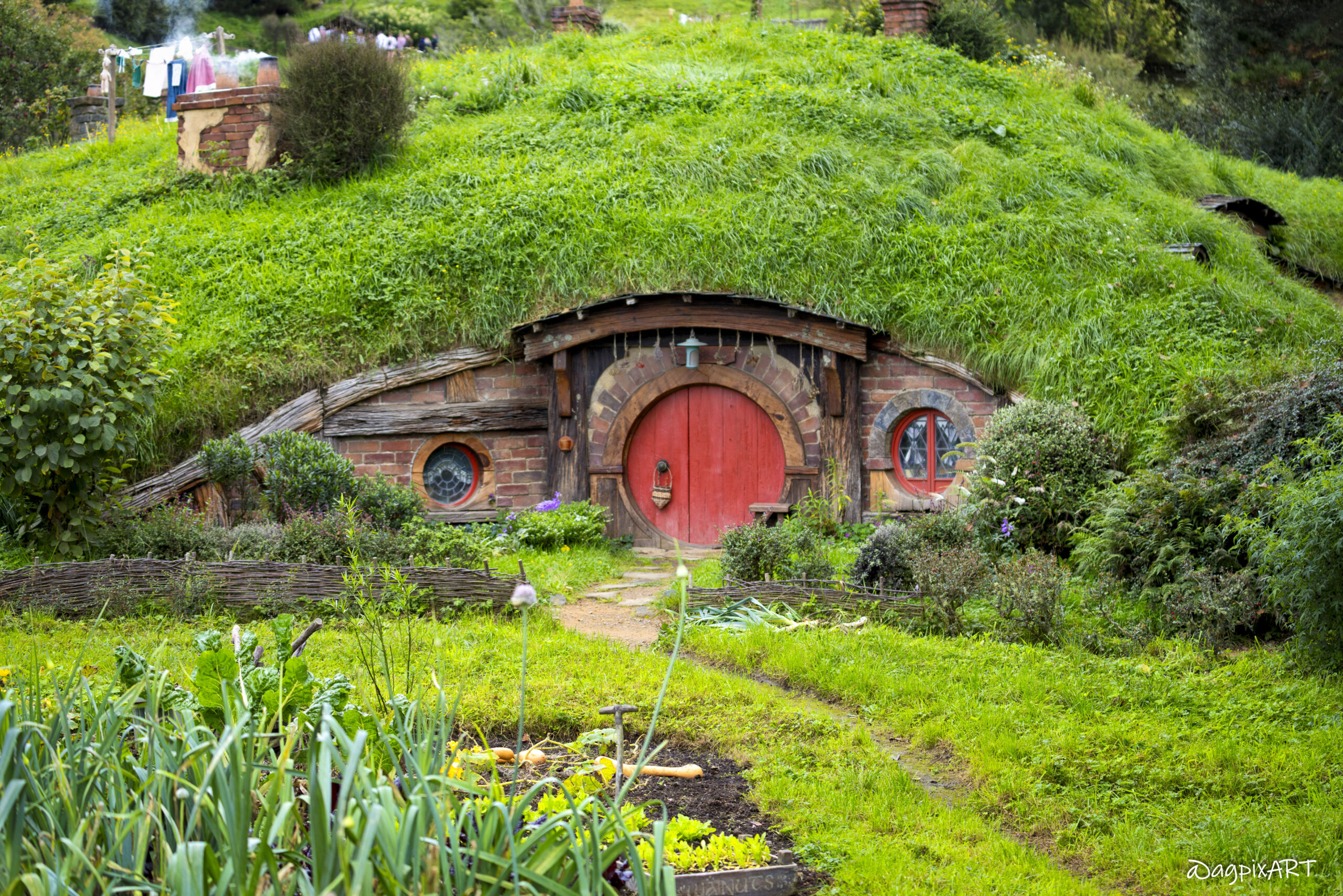
Waikato & Waitomo
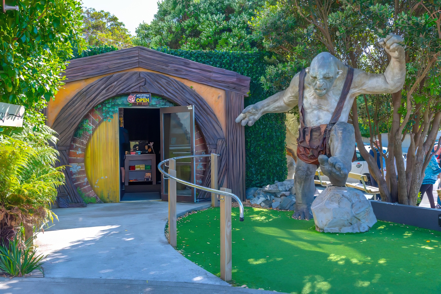
Waikato is the rural heartland of island, known for its lush green farmland, the Waikato River, and the city of Hamilton. It features rich agricultural landscapes and is home to the famous Hobbiton movie set near Matamata. Waitomo is a small but world-famous district within Waikato, renowned for its limestone caves filled with glowing glowworms.
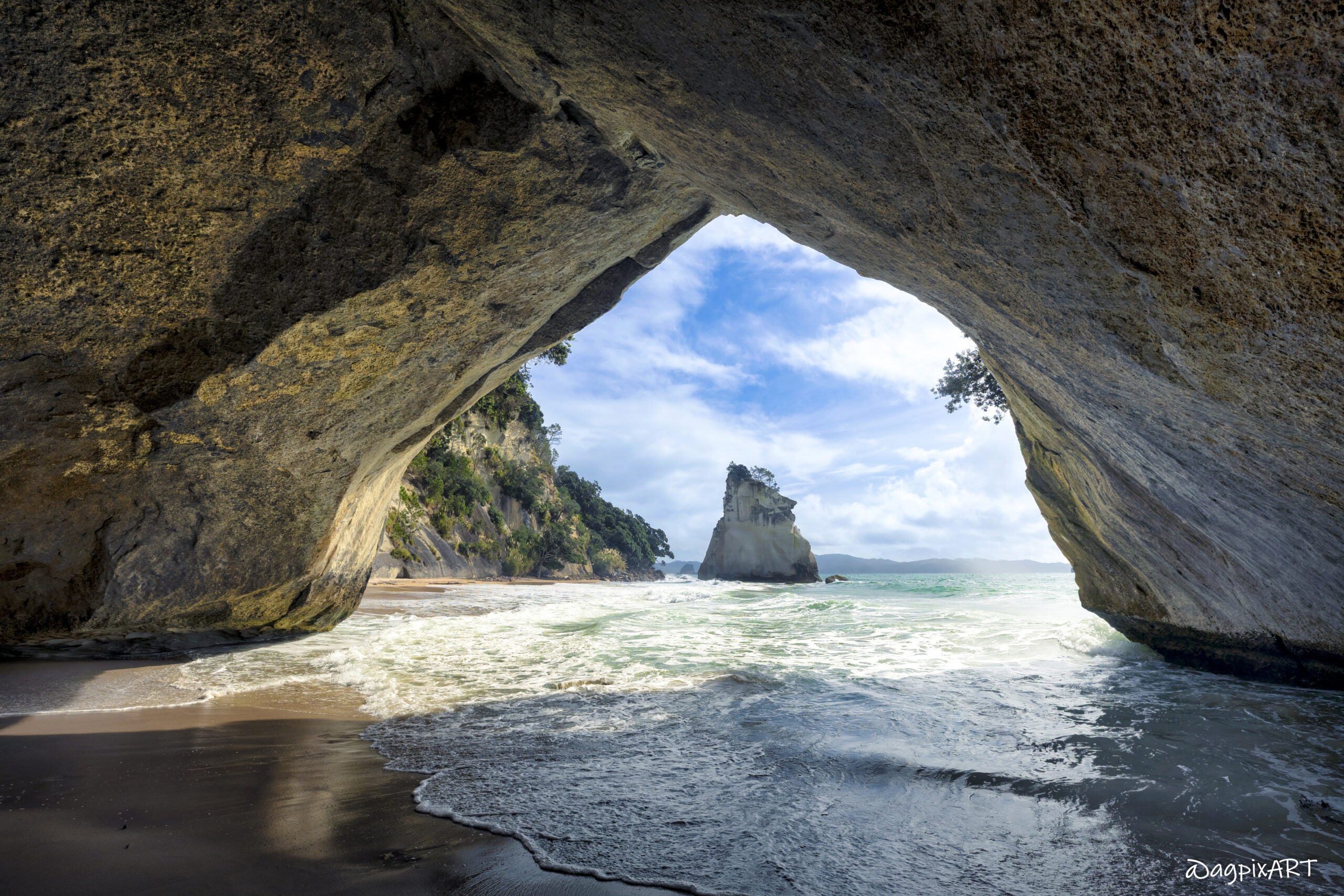
The Coromandel Peninsula
The Coromandel Peninsula is a rugged and beautiful region on the east coast of the North Island, known for its stunning beaches, native forests, and laid-back vibe. Highlights include Hot Water Beach (where you can dig your own thermal pool), Cathedral Cove, the driving loop road, and the historic gold-mining town of Coromandel.
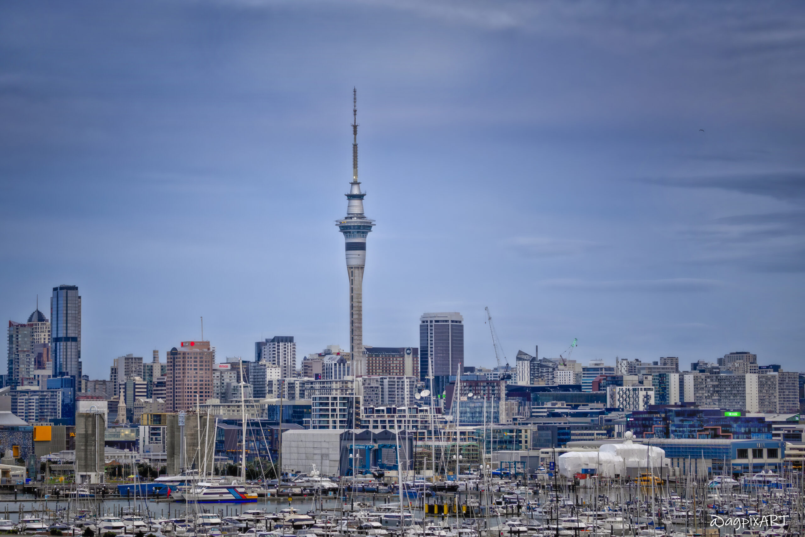
Auckland Region
Auckland is NZ’s largest city and main international gateway, often called the “City of Sails” due to its stunning harbor and countless boats. The region features a mix of urban vibrancy, multicultural neighborhoods, volcanic cones, beautiful beaches, and the Hauraki Gulf islands, making it the most populated and diverse area in the North Island.
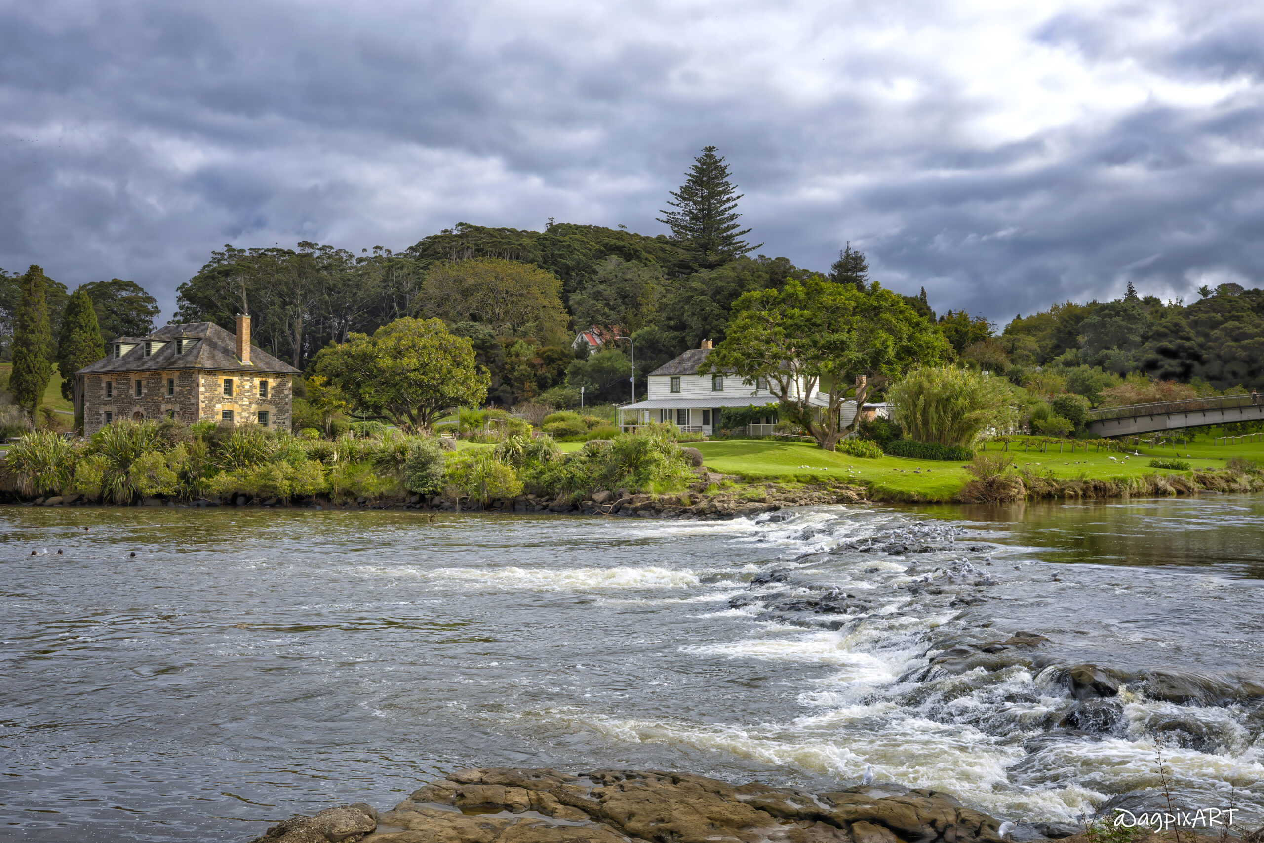
Northland
Northland is the subtropical northernmost region of New Zealand, known as the “winterless north.” It features beautiful beaches, the scenic Bay of Islands, the iconic Cape Reinga where the Tasman Sea and Pacific Ocean meet, ancient kauri forests, and a strong Māori heritage. It offers excellent snorkeling and diving experiences.
