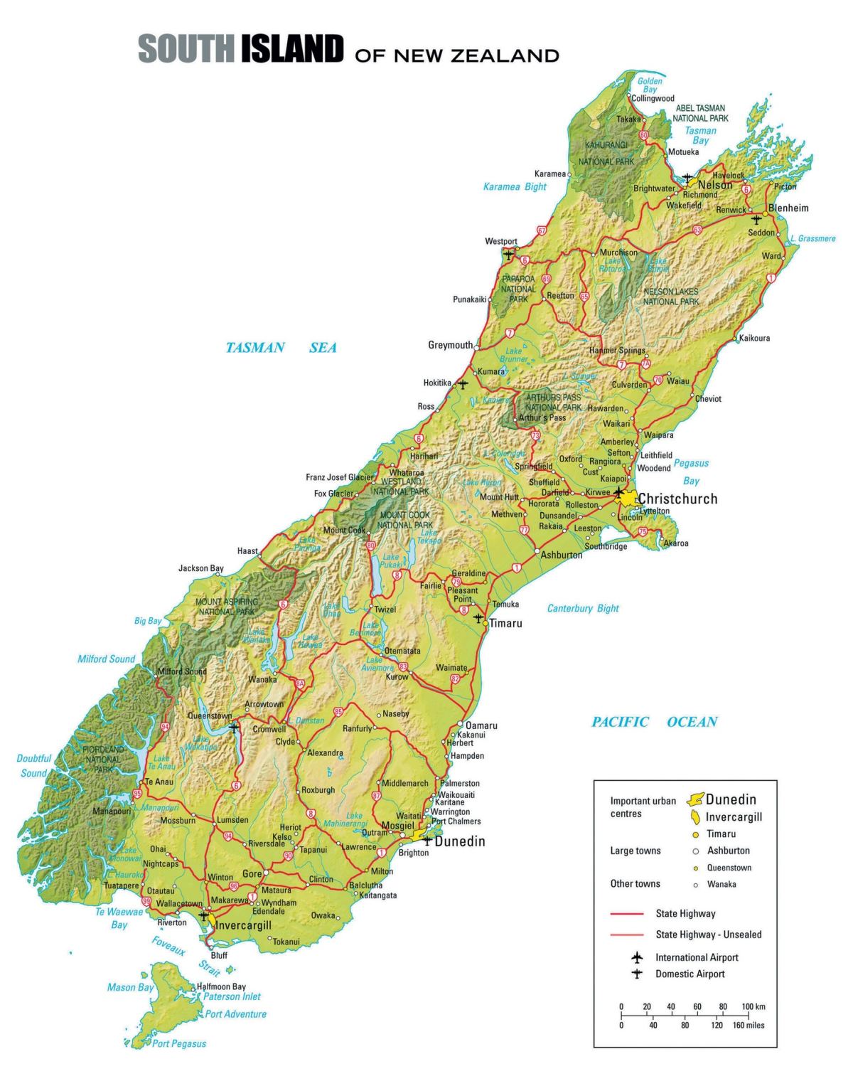
The South Island, New Zealand

The South Island of NZ is a dramatic and wildly beautiful land renowned for its majestic mountains, deep fjords, ancient glaciers, turquoise lakes, and golden beaches.

Home » Destinations » Pacific Islands » New Zealand » South Island, New Zealand

Explore The South Island, NZ
Te Waipounamu, The Waters of Greenstone

The South Island of New Zealand is a dramatic and wildly beautiful land renowned for its majestic mountains, deep fjords, ancient glaciers, turquoise lakes, and golden beaches. Often described as the more scenic and adventurous of the two main islands, it offers some of the most breathtaking landscapes in the world within a relatively compact area.
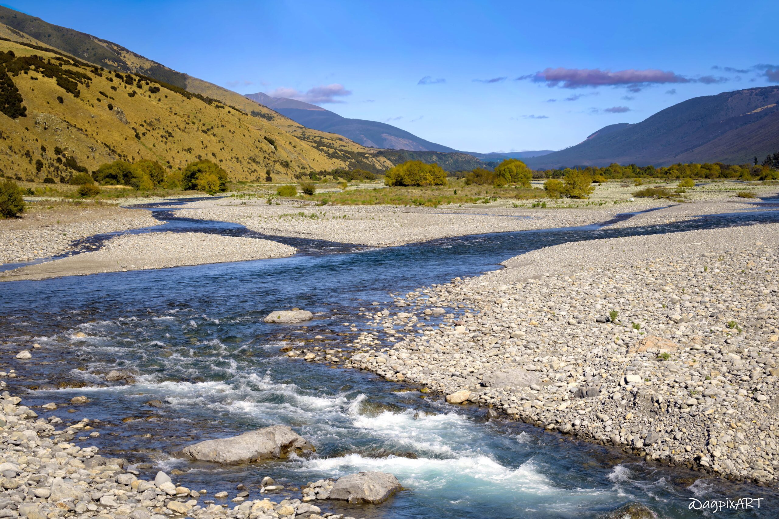
Stretching over 800 km from the sunny vineyards of Marlborough in the north to the remote wilderness of Southland and Stewart Island in the far south, the South Island is dominated by the towering Southern Alps. This rugged spine creates a striking contrast: a wet, lush West Coast rainforest on one side and drier, sunnier plains and high country on the east.
Home to just over 1.3 million people (about a quarter of NZ’s total population), the South Island feels wonderfully uncrowded excluding the most touristy areas as Milford Sound and Queenstown. The main hubs — Christchurch, Queenstown, Dunedin, and Nelson — serve as gateways to world-class experiences. Christchurch is the largest city in the South Island with 365,000 residents.


Good To Know…
  • Weather: Temperate oceanic climate with mild to cool temperatures year-round. Weather can change quickly within a single day. Prevailing westerly winds bring moisture from the Tasman Sea, resulting in heavy rainfall on the western side of the mountains and a rain-shadow effect on the eastern side.
  • Temperature Ranges: Summer (Dec–Feb): Daytime highs 18–25°C (64–77°F), cooler at night (7–12°C / 45–54°F). Inland areas like Central Otago can occasionally reach the low 30s°C. Winter (Jun–Aug): Daytime highs 8–14°C (46–57°F), with nighttime lows often near or below freezing (0°C / 32°F or lower inland). Alpine areas can drop to -10°C (14°F) or colder. Spring & Autumn (Mar–May & Sep–Nov): Mild transitional periods with daytime highs around 13–20°C (55–68°F).
  • Weather-dependent: Many mountain and fjord experiences rely on clear conditions.
  • Pack: Pack layers regardless of when you visit — a waterproof jacket, warm fleece, and comfortable shoes are essential.
  • Sandflies: Small but persistent on the West Coast and Fiordland. Bring strong insect repellent.
  • Mobile coverage: Good in towns, patchy or non-existent in remote areas (West Coast, Fiordland, mountain passes). Download offline maps.
  • Food: Excellent food scene with fresh seafood, world-class lamb, green-lipped mussels, and hokey pokey ice cream.
  • Geography: It’s home to NZ’s highest mountain, Aoraki/Mount Cook (3,724 m / 12,218 ft), and 18 peaks over 3,000 metres.
  • Geography: Milford Sound is technically a fjord (not a sound), and it’s one of the wettest places on Earth, with some areas receiving over 7 meters of rain per year.
  • Fun Fact: The South Island’s Māori name Te Waipounamu means “the waters of greenstone” (pounamu), referring to the precious jade found in its rivers. Another traditional name is Te Waka-a-Māui (“Māui’s Canoe”) — legend says the island is the canoe that the demigod Māui stood in when he fished up the North Island (Te Ika-a-Māui, the fish of Māui).
  • Fun Fact: Commercial bungy jumping was invented here — the first-ever commercial jump was off the Kawarau Bridge near Queenstown in 1988 (Kiwis spell it “bungy”).
  • Movies Filmed: The Lord of the Rings & The Hobbit Trilogies (Peter Jackson), Mission: Impossible – Fallout (2018), X-Men Origins: Wolverine (2009), Alien: Covenant (2017), The Chronicles of Narnia series — Flock Hill and Elephant Rocks (near Castle Hill, Canterbury) were used for battle scenes and Aslan’s camp.
Arriving at the Christchurch Airport (CHC)

CHC — It is the most convenient international airport for the South Island. Good base for Canterbury, Kaikōura, or heading west/south.

Disembark and Immigration: Follow signs for arrivals. Have your passport, completed Passenger Arrival Card (or use the New Zealand Traveller Declaration app if available), and any required visa/NZeTA ready.
Biosecurity & Customs: NZ has very strict biosecurity rules. Declare all food, wooden/plant items, outdoor gear, and hiking equipment. No fresh fruit, meat, dairy, or honey allowed. Sniffer dogs and checks are common. Fines can be heavy if you forget to declare something. No THC/CBD products allowed.
Baggage Claim: One main terminal — domestic and international arrivals are well signposted.
Car Rental: Major companies (including Enterprise, Alamo, National, Hertz, Avis, etc.) have counters right in the International Arrivals hall. Some offer on-site pickup; others provide a short shuttle from Door 2. Book in advance, especially if you need a specific vehicle type.

Useful Tips for a Smooth Arrival
  • Allow extra time after landing for biosecurity and customs (can take 30–90 minutes depending on queues).
  • Have your NZeTA and International Visitor Conservation and Tourism Levy (IVL) sorted before travel.
Driving & Road Tips
  • Drive on the left.
  • Roads are often winding, narrow, and scenic, underestimate drive times by adding 30–50% extra. Don’t plan more than 3–5 hours driving per day.
  • One-lane bridges are everywhere — slow down, check for oncoming traffic, and follow priority signs.
  • Many of the railway crossing have no guards.
  • Fuel up regularly in remote areas (e.g., before heading to Milford Sound or glaciers).
  • Mountain passes and higher roads can be affected by snow, ice, or strong winds in winter.
  • Always check forecasts and road conditions (NZTA and MetService) before driving, as weather impacts roads, ferries, and outdoor activities.

The South Island, NZ – Regions
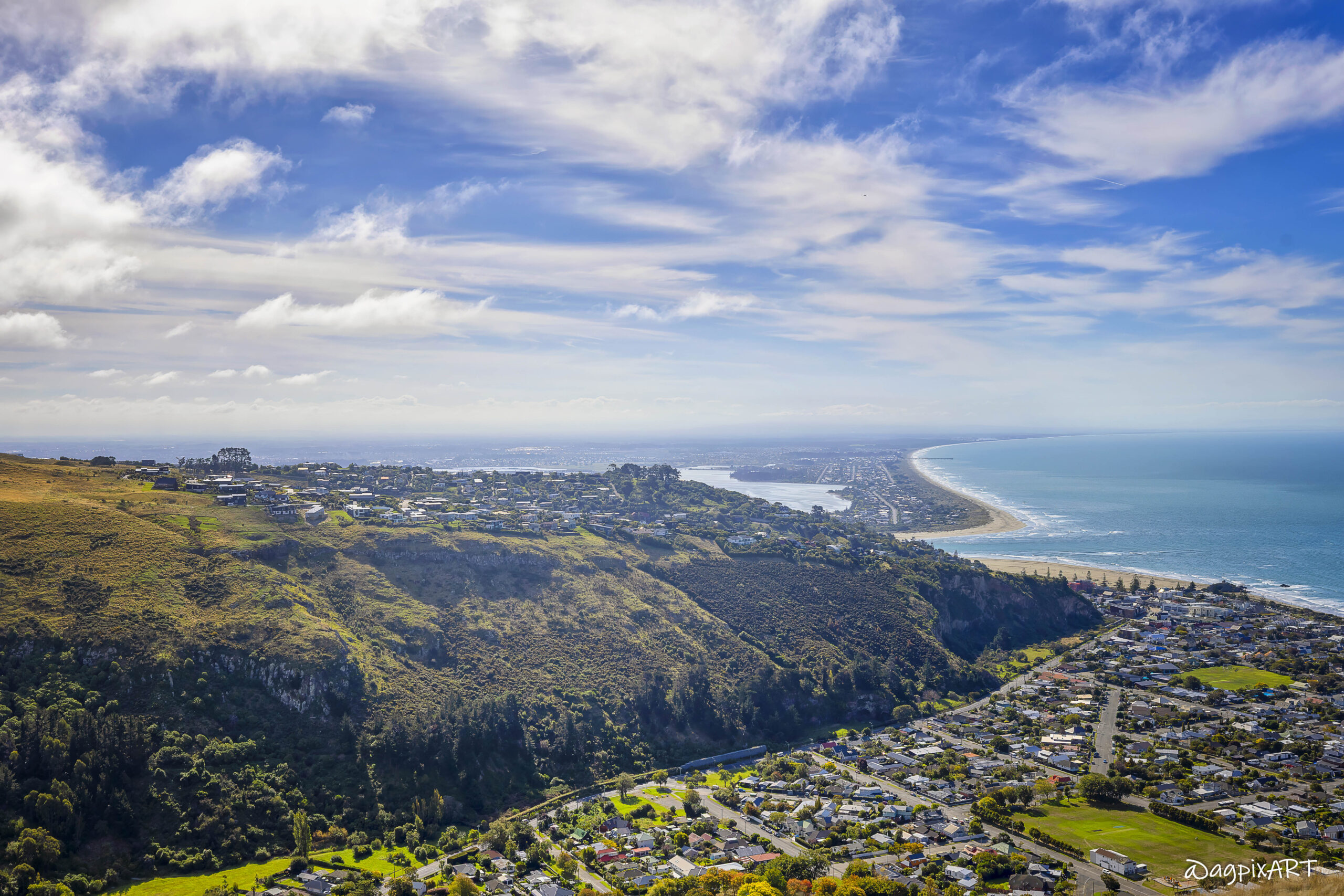
Central South Island
Canterbury

It is home to Christchurch, the South Island’s largest city with gardens, street art, and recovery architecture. The area includes the Canterbury Plains, Banks Peninsula (Akaroa), and Arthur’s Pass National Park. It offers a great mix of city and nature.

Central South Island
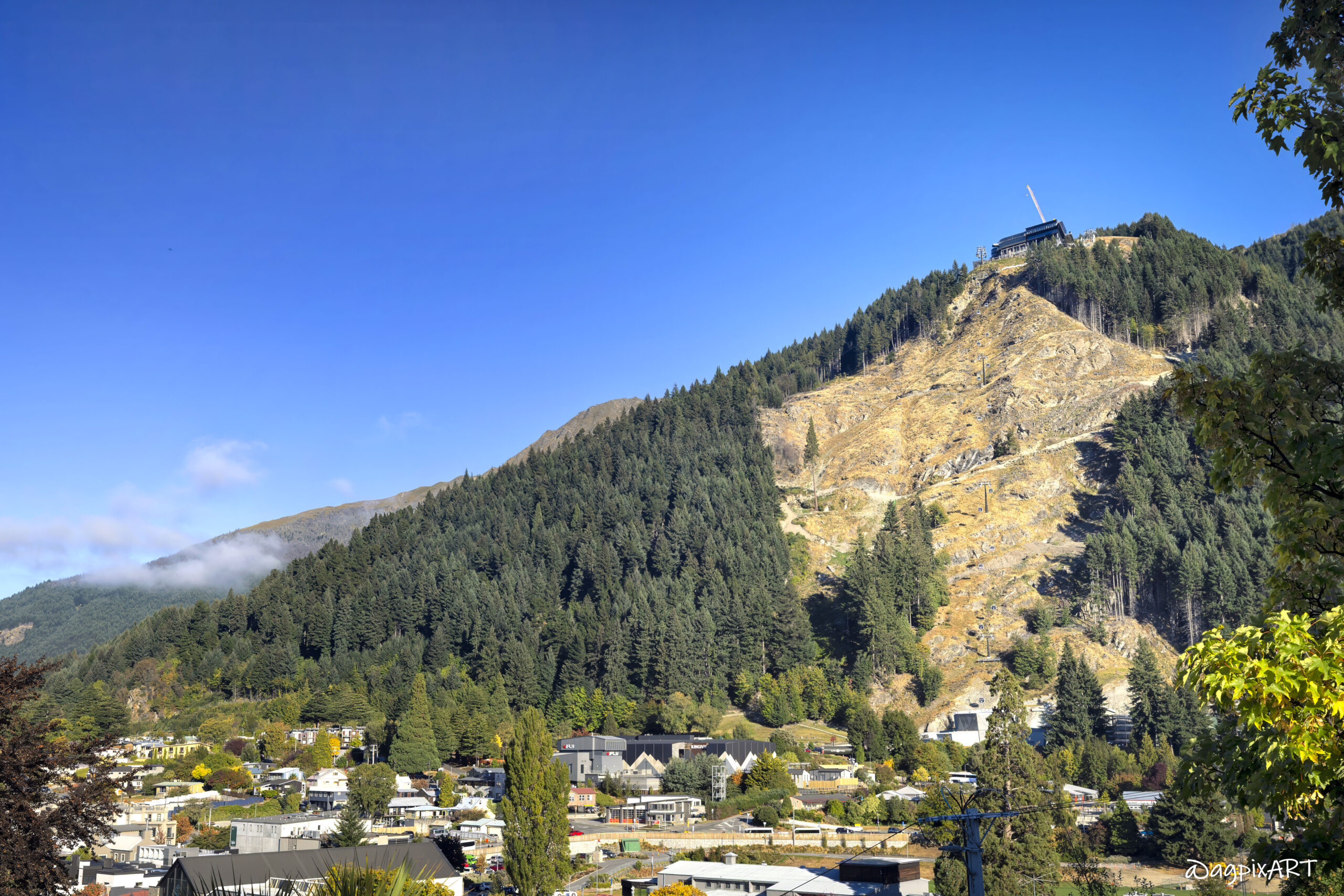
Central Otago (including Queenstown and Wanaka)

Queenstown is known as the Adventure/Adrenalin Capital, offering activities like bungee jumping, jet boating, skiing, and ‘Lord of the Rings’ locations. It is also one of the busiest tourist spots. Nearby Wanaka offers a quieter lakeside vibe with great hikes.

Central South Island
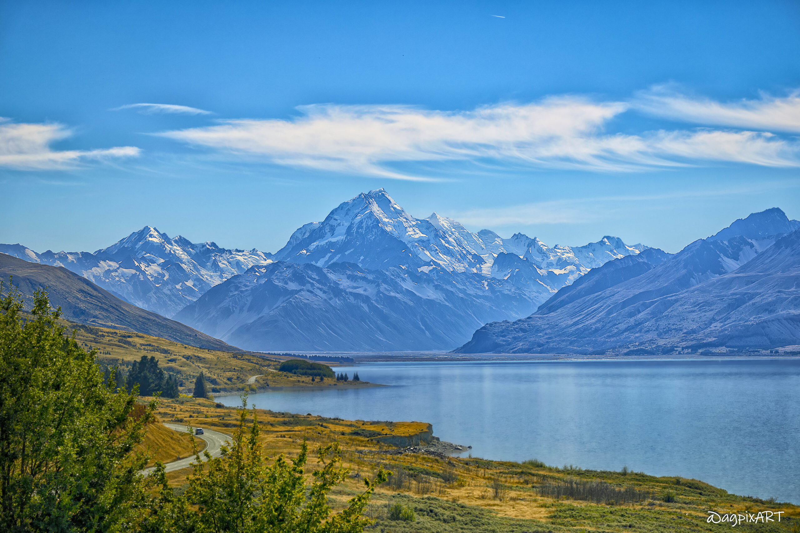
Mackenzie Region/Aoraki-Mount Cook

This area offers dramatic alpine scenery with NZ’s highest peak (Aoraki/Mount Cook) and turquoise lakes (Tekapo and Pukaki). It is ideal for hiking and mountain views. It is one of the most dramatically beautiful and sparsely populated areas.
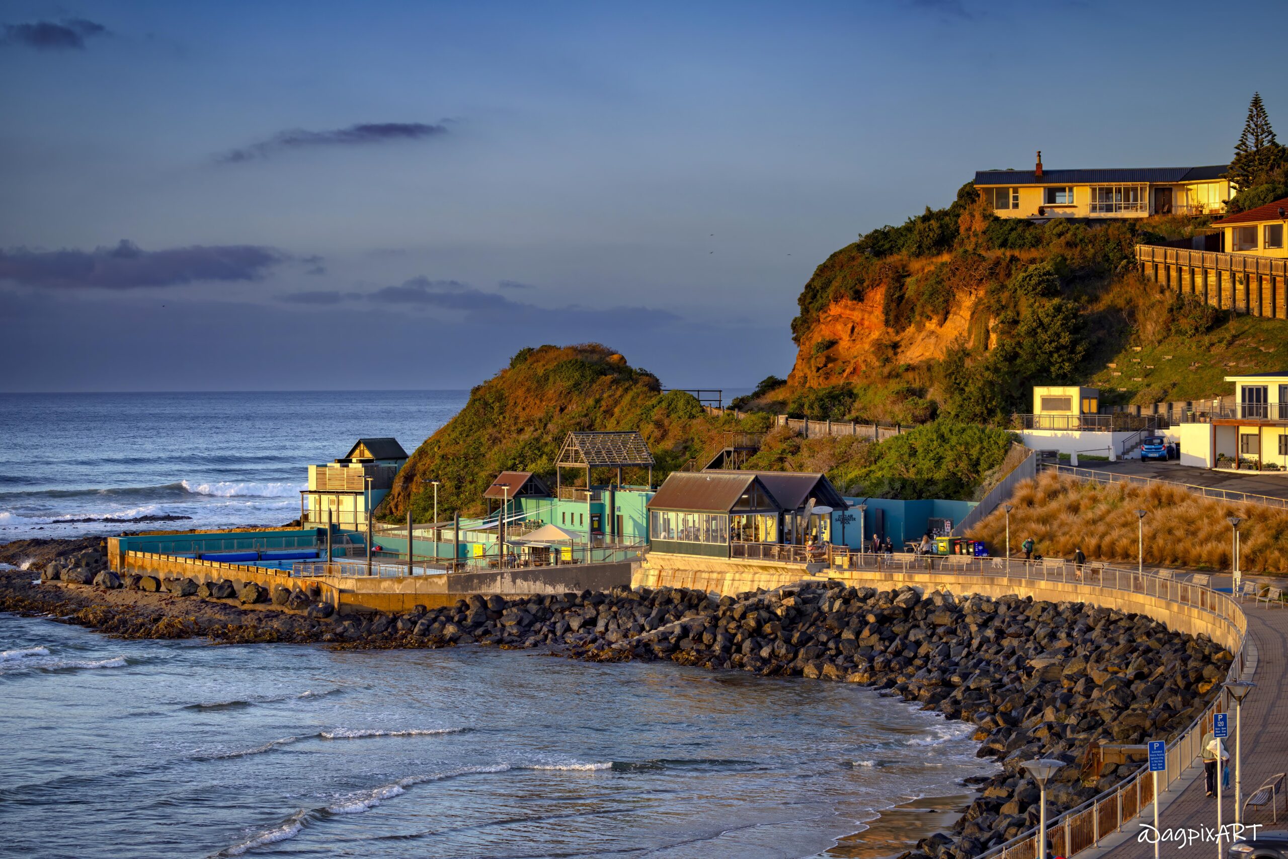
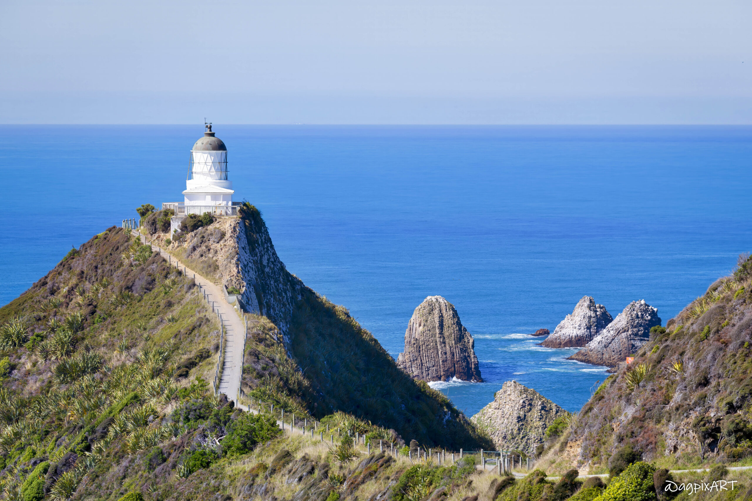
Lower/eastern South Island
Dunedin & Otago

Dunedin offers Scottish heritage, wildlife, and historic charm. The wider Otago region combines natural landscapes with deep human history, highlighted by coastal wildlife experiences.

Lower/Southern South Island
Southland (without Fiordland)

It occupies the bottom of the island, stretching from the rugged Fiordland wilderness in the west to the open plains and coastline around Invercargill in the east, and Stewart Island/Rakiura further south.
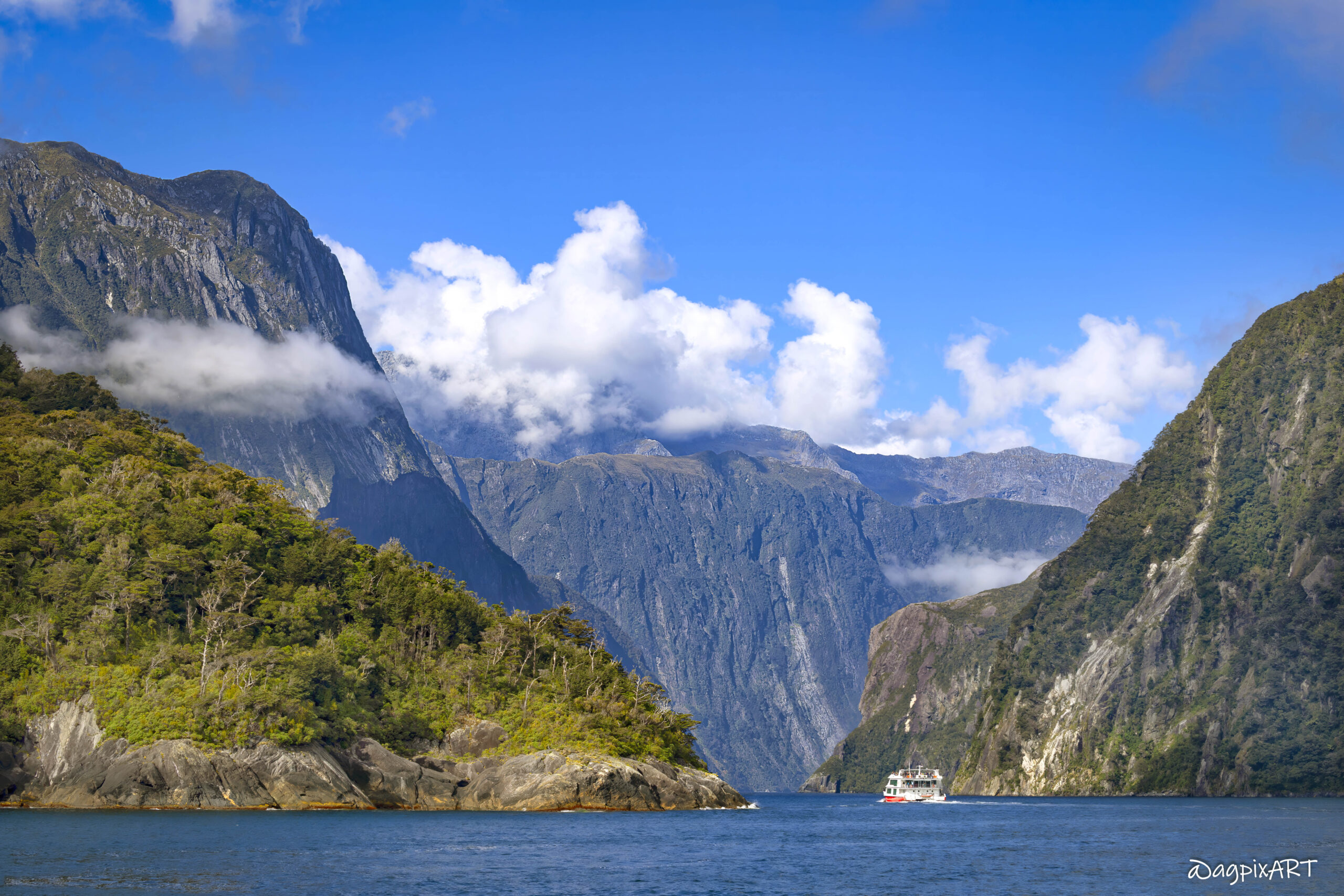
Lower/Southern South Island
Fiordland

Part of the Southland region the rugged Fiordland wilderness occupies the west bottom of the island with Te Anau as its the gateway. It includes the iconic Milford Sound.
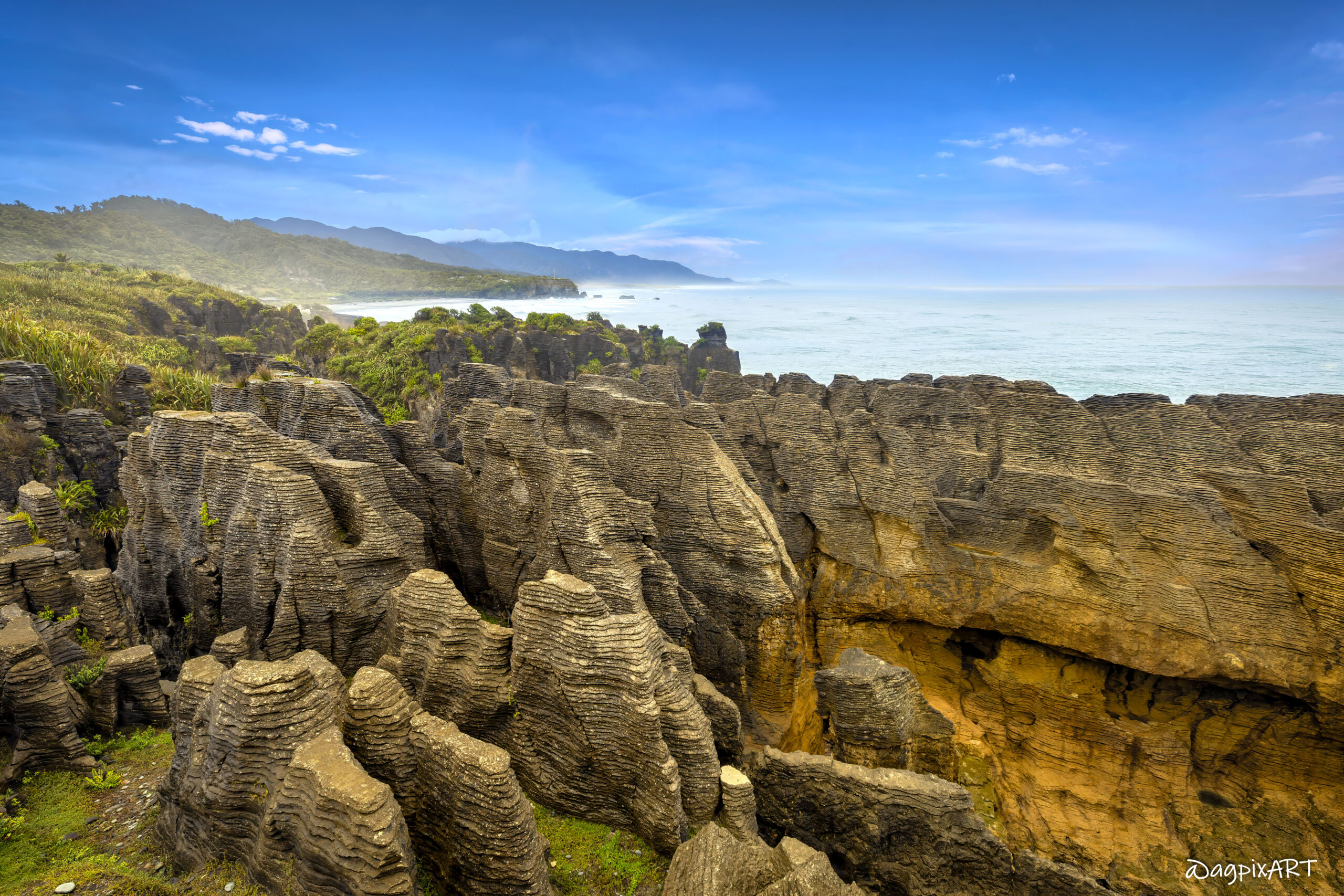
the west
West Coast

Rugged and wild with high rainfall, lush rainforests, and the famous Franz Josef and Fox Glaciers. Highlights include Punakaiki Pancake Rocks, Hokitika (greenstone/jade), and remote beaches. Feels adventurous and untamed.

Upper/Top of the South
Marlborough

Marlborough is famous for Sauvignon Blanc vineyards and the scenic Marlborough Sounds. Picton is the ferry port from the North Island; Kaikōura (nearby) offers whale watching and seafood.

Upper/Top of the South
Nelson Tasman

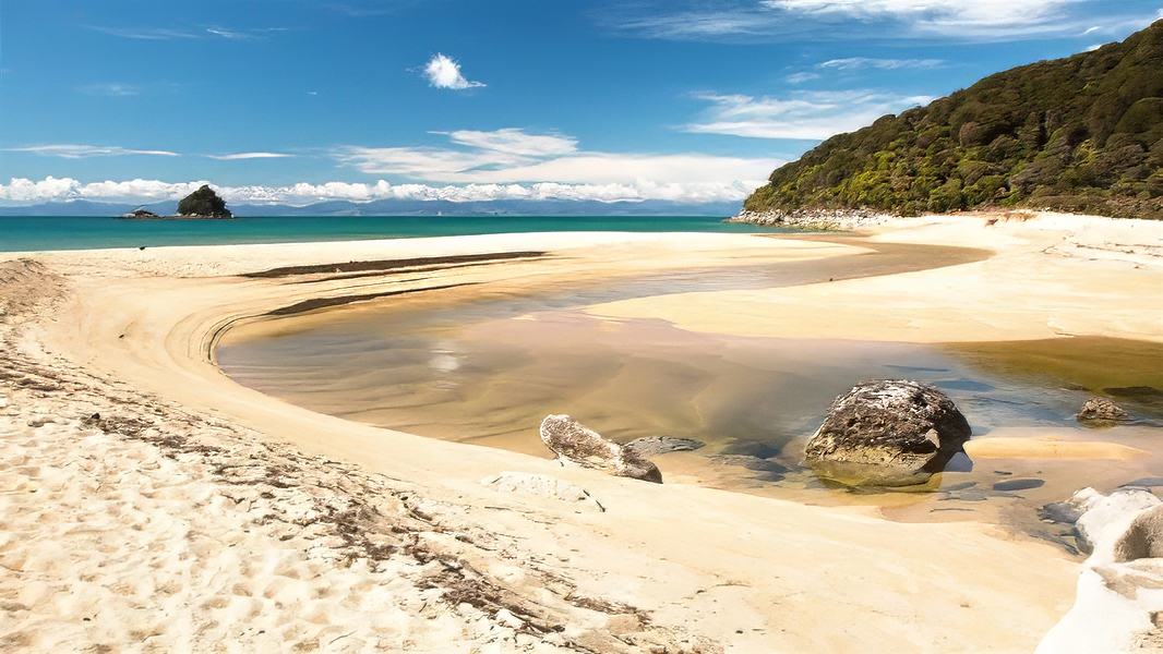
NZ’s sunniest region with golden beaches, Abel Tasman National Park, the smallest but one of its most popular national parks (coastal walks, kayaking), boutique wineries, and artsy Nelson city. Perfect for relaxed beach and outdoor time.


The South Island NZ – Attractions, Info & Map

EDI, Scotland’s busiest airport, 5.8 miles west of the city center, handles over 15 million passengers annually.

Edinburgh Castle, a crown jewel of Scotland’s storied past, looms majestically atop Castle Rock, anchoring the Royal Mile in the heart of Edinburgh’s Old Town. Dating back to at least the 12th century, the castle has been a royal residence, military stronghold, and symbol of Scottish identity. It housed kings like James VI (and I of England) and survived sieges during the Wars of Independence, tying into Scotland’s warrior legacy.

Calton Hill, one of Edinburgh’s seven hills, is a UNESCO World Heritage gem perched in the city’s heart, offering panoramic views and a rich tapestry of history that echoes Scotland’s Celtic soul and dramatic landscapes. At 103 meters above sea level, Calton Hill delivers sweeping vistas of Edinburgh’s skyline—Arthur’s Seat, Edinburgh Castle, the Firth of Forth, and the Old and New Towns. Known as Edinburgh’s “Acropolis,” it hosts iconic structures like the National Monument, an unfinished Parthenon-like tribute to Scottish soldiers fallen in the Napoleonic Wars, and the Nelson Monument, commemorating Admiral Nelson’s 1805 Trafalgar victory.

The Scott Monument, a towering Gothic masterpiece in Edinburgh’s New Town, stands as a tribute to Sir Walter Scott, Scotland’s literary giant whose works like Ivanhoe and Waverley celebrated the nation’s Celtic heritage and rugged landscapes. Built in 1844, this 61.1-meter (200.5 ft) spire honors Sir Walter Scott, whose romantic novels and poems immortalized Scotland’s myths, clans, and landscapes—think Highland glens and tartan-clad heroes, resonating with the Celtic roots you admire.

The National Museum of Scotland, located in the heart of Edinburgh’s Old Town, is a treasure trove of the nation’s history, culture, and innovation. The museum showcases Scotland’s story, from ancient Celtic artifacts to modern scientific breakthroughs, reflecting the rich heritage you admire (e.g., tartans, whisky, Robert Burns, and David Hume). It connects the rugged Highlands and islands like Skye to Edinburgh’s urban pulse.

The official Scottish residence of the British monarch, 16th-century the Palace of Holyroodhouse is steeped in Celtic and royal history, home to Mary, Queen of Scots, and her dramatic tale of intrigue (think murders and betrayals). Its Baroque architecture and gardens offer a regal contrast to the rugged Highlands you’ll explore. The Café at the Palace offers scones and tea (£5-£10).

Arthur’s Seat in Holyrood Park, a 251-meter volcanic hill is a part of an ancient volcano and offers offers Edinburgh’s best panoramic views and a mini-Highland adventure in the city, with its windswept trails echoing Skye’s rugged cliffs.

A vibrant historic square and colorful street, Grassmarket was once a medieval marketplace and execution site, now buzzing with pubs and shops. Victoria Street, with its curved, rainbow-hued facades, inspired Harry Potter’s Diagon Alley. Victoria Street’s is surronded by quirky boutiques (think whisky and tartan).

Scottish National Gallery located in New Town, The Mound, is a world-class art collection showcasing Scotland’s cultural legacy, from Celtic-inspired works to European masters, complementing the intellectual tradition you noted (e.g., David Hume). Its neoclassical building sits between Old and New Towns, tying to Edinburgh’s UNESCO status.

Rosslyn Chapel, located in Roslin, Midlothian, Scotland, is a 15th-century Gothic masterpiece founded in 1446 by Sir William St Clair. Officially named the Collegiate Chapel of St Matthew, it’s renowned for its intricate stone carvings, which include biblical scenes, mythical creatures, and enigmatic symbols like the “Green Man” and possible Masonic or Templar motifs. These have sparked speculation about hidden meanings, famously popularized by The Da Vinci Code, though many claims are debated by historians.
Built as a private chapel for the St Clair family, it was intended to be part of a larger cruciform church, but only the choir was completed. Its architecture features pointed arches, ribbed vaults, and detailed ornamentation, reflecting late medieval craftsmanship. The chapel’s Apprentice Pillar, with its elaborate carvings, is tied to a legend about a jealous master mason murdering his apprentice.
After centuries of neglect, the chapel was restored in the 19th and 20th centuries and remains a functioning church under the Scottish Episcopal Church. Managed by the Rosslyn Chapel Trust, it attracts visitors for its historical and architectural significance, as well as its cultural mystique. Open daily, tickets cost around £9.50 for adults, with guided tours and photography restrictions in place.

The National Mining Museum Scotland, located at the Lady Victoria Colliery in Newtongrange, Midlothian, about 8 miles south of Edinburgh, is a 5-star visitor attraction dedicated to preserving Scotland’s coal mining heritage. Established in 1984, it occupies one of Europe’s best-preserved Victorian collieries, opened in 1895 as Scotland’s first super-pit and operational until 1981. The museum showcases the history, technology, and social impact of coal mining through exhibitions, guided tours, and a vast collection of over 60,000 artifacts, including tools, safety equipment, and large machinery like Scotland’s largest steam winding engine.

Gosford House is a neoclassical country house located about 2 miles northeast of Longniddry in East Lothian, Scotland, on the A198 Aberlady Road, set within 5,000 acres of parkland and coastline along the Firth of Forth. Designed by the renowned Scottish architect Robert Adam for the 7th Earl of Wemyss, it was constructed between 1790 and 1800, though completed after Adam’s death in 1792. It remains the family seat of the Charteris family, the Earls of Wemyss and March, with the south wing serving as the private residence of the 13th Earl, James Charteris, though he primarily lives in Gloucestershire.
The house is a prime example of neoclassical design, featuring a double-pile mansion with a polished yellow ashlar facade, pedimented windows, and a marble hall in the south wing, added in 1891 by architect William Young for the 10th Earl. The Marble Hall, with its three-story height, double staircase, alabaster colonnades, and Italianate décor, is a highlight. The central block, damaged by a 1940 fire during WWII army occupation, is still under restoration, with dry rot issues affecting the north wing.
The house boasts an extensive collection of paintings, porcelain, and antique furniture. Notable features include the Palladian screen of Venetian windows and a Rodin sculpture in the Marble Hall.
The house is open to the public on limited days, primarily during Spring (April 17–21, 2025) and Summer (July 31–August 25, 2025, Thursday–Monday). Guided tours (45-minute or 1.5-hour options) cover the south wing, Marble Hall, and central block. Photography is prohibited inside.

Dirleton Castle, located in the village of Dirleton, East Lothian, Scotland, about 3 miles west of North Berwick and 20 miles east of Edinburgh, is a medieval fortress with a history spanning over 700 years. Managed by Historic Environment Scotland, it’s celebrated for its well-preserved ruins, picturesque gardens, and strategic coastal location near the Firth of Forth.
Founded around 1240 by the de Vaux family as a stone castle, it replaced an earlier timber fort possibly used by King David I. It passed to the Haliburton family in the 14th century, then to the Ruthvens in 1505, who added Renaissance-style enhancements. The castle was damaged during Cromwell’s 1650 siege, rendering it uninhabitable, and was abandoned by 1663. Its grounds were later transformed into gardens by the Nisbet family, who built a new mansion nearby.
The castle showcases medieval military design with 13th-century towers, a massive round tower (one of Scotland’s oldest), and a 16th-century gatehouse and dovecot. The great hall, kitchens, and vaulted cellars reflect its once-grand status.
The castle’s gardens, reimagined in the 1920s, feature a formal Victorian west garden, an Arts and Crafts herbaceous border (one of the world’s longest), and a 1930s north lawn.

Tantallon Castle, perched on a dramatic clifftop overlooking the Firth of Forth near North Berwick, East Lothian, Scotland, is a formidable 14th-century fortress renowned for its historical significance, striking architecture, and stunning coastal views. Managed by Historic Environment Scotland, it’s a must-visit for its medieval ruins, connection to Scottish history, and proximity to Bass Rock.
Built around 1358 by William Douglas, 1st Earl of Douglas, Tantallon was the last major curtain-walled castle constructed in Scotland. It served as a stronghold for the powerful Douglas family, who dominated southeast Scotland. The castle endured sieges during the Wars of Independence, a 1528 assault by James V, and a devastating 1651 bombardment by Cromwell’s forces, which left it in ruins. It passed to the Dalrymple family in 1699 and was abandoned until taken into state care in 1924.

Bass Rock, a dramatic volcanic island in the Firth of Forth, 2 miles off North Berwick, East Lothian, Scotland, is one of the world’s most significant seabird colonies and a striking historical site. Rising 107 meters above sea level, this steep-sided basalt plug, formed 340 million years ago, is best known as the home of the largest northern gannet colony, hosting over 150,000 birds at peak season. Its strategic location also made it a medieval fortress, prison, and lighthouse site.
Bass Rock is a Site of Special Scientific Interest (SSSI) and Special Protection Area, famed for its gannet colony, which covers the rock in white during breeding season (March–September).
The rock has a 1,400-year human history. St. Baldred, a 7th-century hermit, lived here, giving it spiritual significance. In the 14th century, it became a fortress for the Lauder family. During the 17th century, it served as a Jacobite prison, notably holding Covenanters and later Blackadder family prisoners until 1694. A lighthouse, built in 1902 by David Stevenson, still operates.
Formed from a volcanic plug, Bass Rock’s steep cliffs and caves make it nearly inaccessible except by boat. Its white appearance, often mistaken for snow, comes from gannet guano, earning it the nickname “the white rock”.

Quarrel Sands is a coastal area near North Berwick in East Lothian, Scotland, along the Firth of Forth. The term “quarrel” in Scots can refer to a quarry or stone pit, suggesting the area may have historical ties to quarrying activities, though specific evidence for this at Quarrel Sands is limited.
Located on the clifftops above Quarrel Sands, DRIFT Café is a popular agritourism spot made from upcycled shipping containers. Opened in 2018 by Jo and Stuart McNicol, it offers homemade baking and stunning views of the Firth of Forth, making it a draw for visitors.

Seacliff Beach, located 4 miles east of North Berwick in East Lothian, Scotland, is a secluded, privately-owned beach celebrated for its scenic beauty and historical features. The 700-meter sandy bay, backed by cliffs and woodlands, offers stunning views of Bass Rock, home to the world’s largest gannet colony, and the ruins of Tantallon Castle to the north. It is reached via a private road off the A198 south of North Berwick, near Auldhame. A coin-operated barrier charges £5 per car for all-day parking (as of 2025). Pedestrian access is free. The car park is a short walk from the beach, but steep steps may challenge those with mobility issues.

Belhaven Beach, also known as Belhaven Bay, is a stunning, mile-long sandy beach within the John Muir Country Park, located just west of Dunbar in East Lothian, Scotland, along the Firth of Forth. Renowned for its natural beauty, expansive golden sands, and the iconic “Bridge to Nowhere,” it’s a popular destination for walking, picnicking, surfing, and wildlife watching. It is reached via Shore Road or Linkfield car park (Dunbar, EH42 1NX), off the A1087 west of West Barns


The South Island NZ – Sample Photos
(Click on Photo for More Info)

South Island – Key Regions & Attractions


Home » Destinations » Pacific Islands » New Zealand » South Island, New Zealand